3D Modeling For Civil Engineers
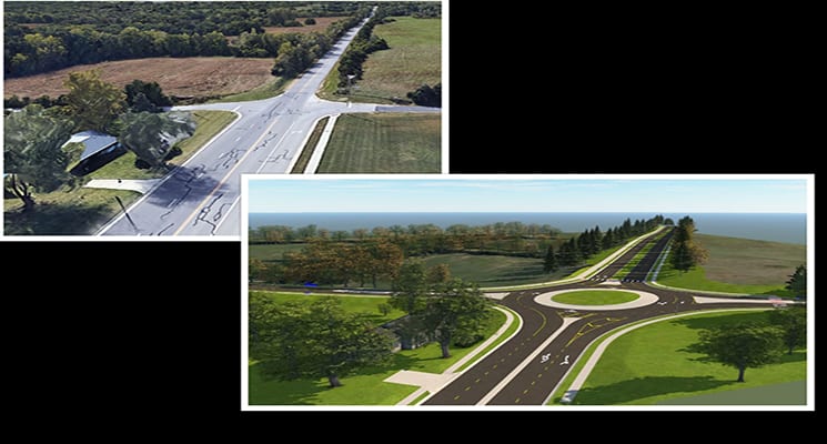
How we communicate civil engineering designs requires a knowledge of plan sets and a bit of imagination. 3D modeling though, creates a compelling visual experience allowing engineers to analyze and visualize designs with real world context. This aids in the overall design process and can prevent issues during construction. Software such as InfraWorks allows civil engineers to seamlessly integrate an otherwise flat design with 3D components such as topographic features – creating an image/video customers can easily understand.
At BHC, our engineers use three types of 3D models:
1. Visibility Model – This model identifies sight lines from public access points that may influence business traffic or evaluate general lines of sight for vehicles and pedestrians.
This model shows:
- Proposed Topographic Surfaces
- Basic Material Surface
- Basic Component Road
- General Proposed Building(s)
- Sight-Inhibiting Features (Walls or Terrain)
2. Alternative Analysis Model – The purpose of this model is to create better visualizations of site layouts.
This model shows:
- Site Defining Material Surfaces
- Proposed Topographic Surfaces
- Basic Material Surface
- Basic Component Road
- General Proposed Building(s)
- Sight-Inhibiting Features (Walls or Terrain)
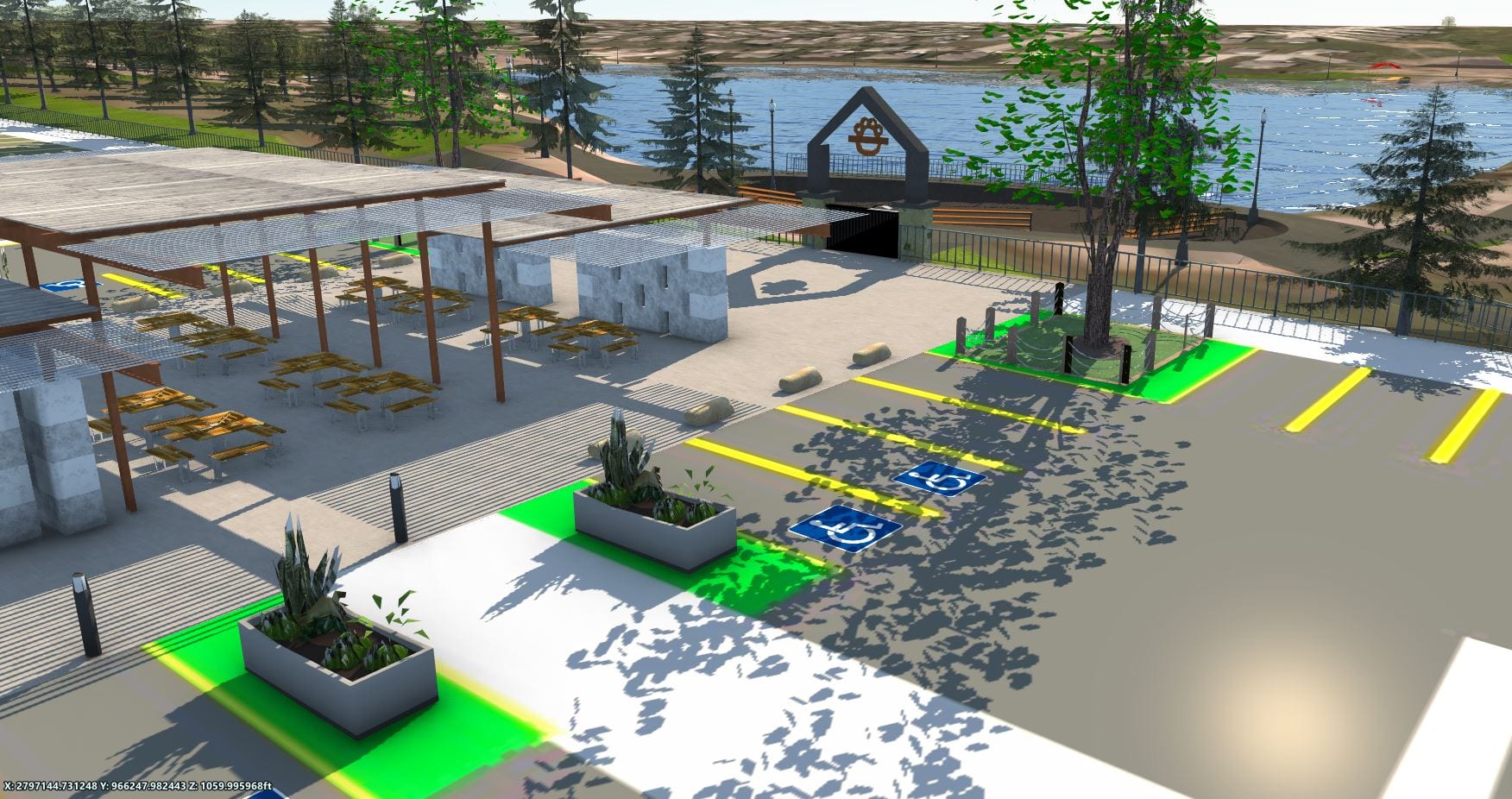
3. Proposed Improvements Model – The purpose of this model is to show with as much accuracy as possible, what the final project will look like at completion.
This model shows:
- Every Material Surface
- Realistic Component Road
- Sketchup/Revit Building Model
- Landscaping & City Furniture
- Proposed Topographic Surfaces
- Sight-Inhibiting Features (Walls)
Proposal Phase
3D modeling provides companies the opportunity to show their understanding of project criteria and visually provide examples on what the completed project might look like. At BHC, engineers use the Alternative Analysis Model to present the three-dimensional aspect of the project site. Allowing the customer to understand how different building locations, parking layouts, or street configurations, can affect cut/fill quantities, addition/subtraction of retaining walls, slopes of drives and entrances of their project.
Design Phase
In this stage, the customer has selected a design to proceed with. A model is chosen based on a customer’s needs and wants and engineers add features based on the level of accuracy desired. Depending on the model, a customer may receive high resolution photographs/videos and access to a web browser version of the site.
When using a 3D model during the design process, engineers can evaluate their designs along the way, rather than during construction. This mitigates potential construction problems and allows the customer and engineer to make final changes. During this phase the customer has the ability to show other stakeholders the proposed improvements before construction begins.
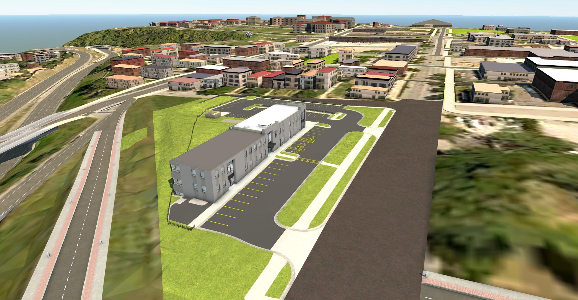
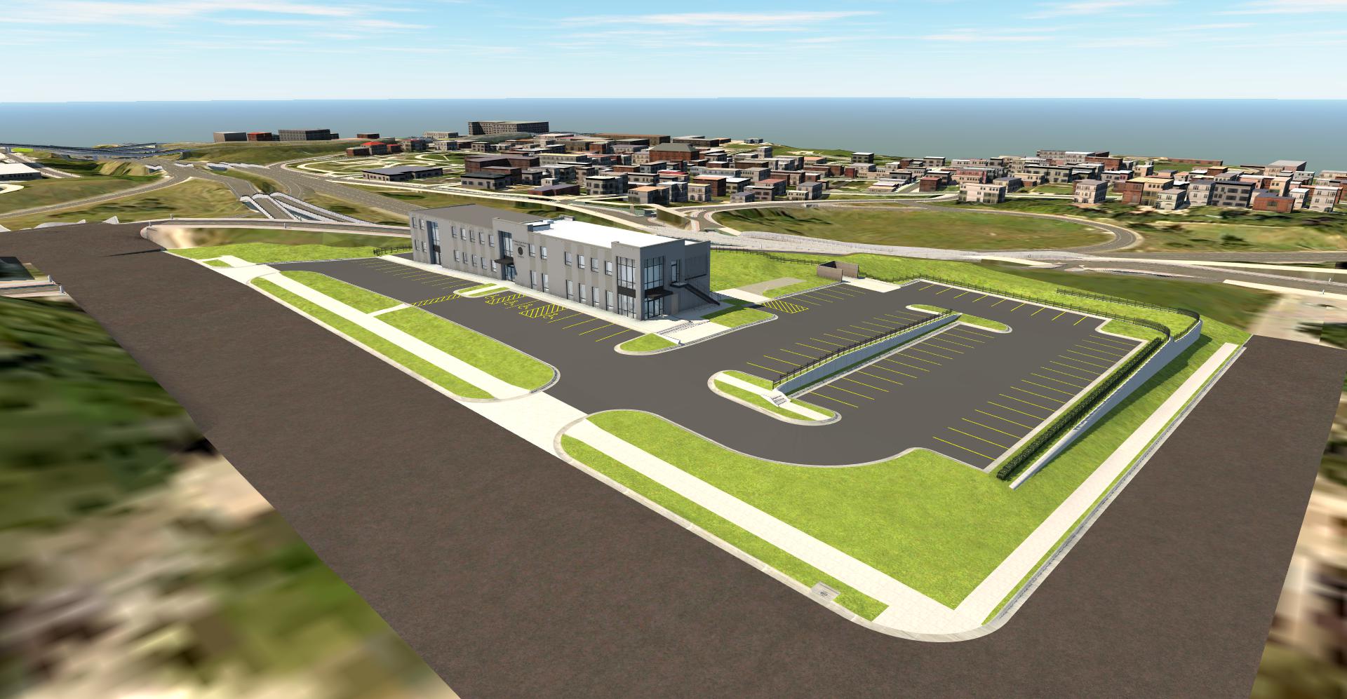
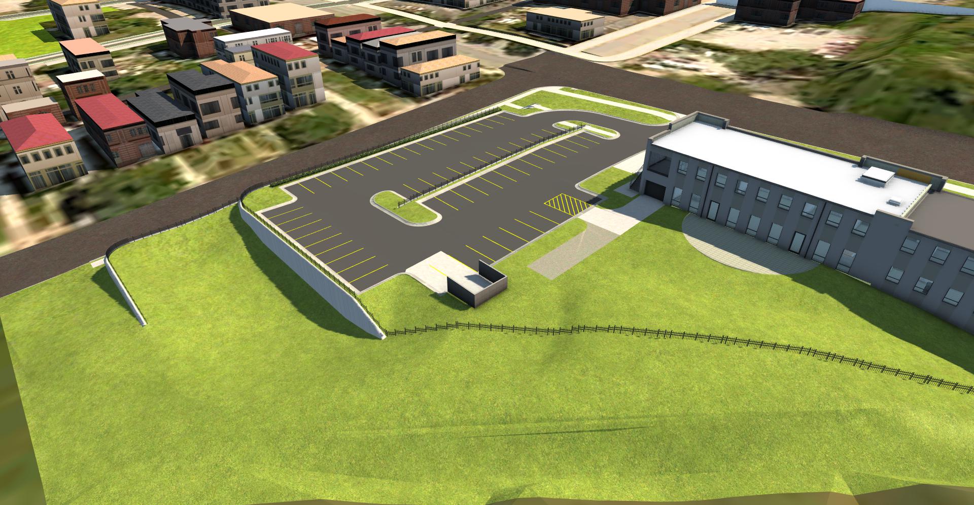
Project Example: International Brotherhood of Electrical Workers (IBEW) – Local 53
During the design process for the IBEW Local 53 building & parking lot addition, a Proposed Improvements Model was used to show what the addition of a building and parking lot would look like at completion. During the process, the customer was able to make changes based on what they liked/did not like from the 3D model. This prevented future change orders during the construction process. The high-resolution renderings of the site were also used for posters and signs by the customer to relay the finished site to their employees.
Why Use 3D Modeling
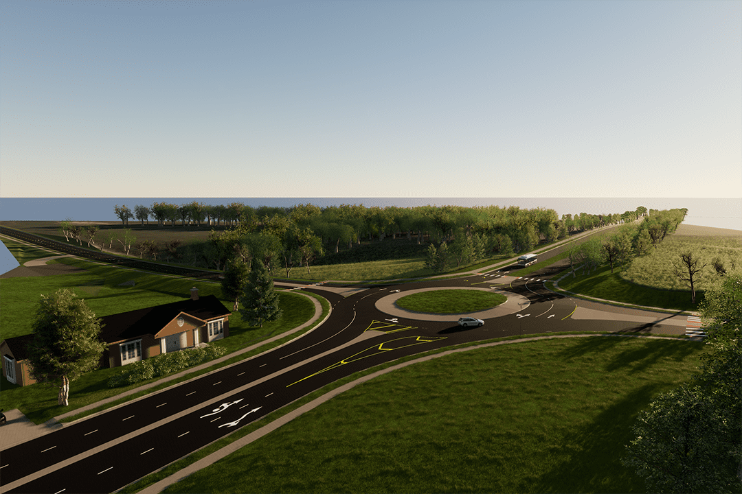
Cities can use 3D modeling to make informed decisions. Models can be used at public meetings to explain current or future projects to citizens. Recently, DeSoto, Kansas used 3D models to choose what restaurant signs to place along the highway. This process was quick and granted the city an accurate representation of what to expect as a project outcome.
Here at BHC, engineers are trained in InfraWorks software and can view their creations to correct any unseen issues/possible errors. To learn more contact Randall Gorton, P.E. Public Works Segment Lead or Mark Sherfy, P.E. Development Segment Lead for more information.