
Mine Stability Assessment Through Surveying & Geotechnical Engineering
Scattered underneath Kansas City’s metropolitan area lies miles of limestone mines. While some are currently being used for business operations and storage facilities, many still remain abandoned to this day after being used in the late 1800s into the early 1900s for limestone mining.
These abandoned mines often require extensive investigation by surveyors and geotechnical engineers to assess the stability of their mined areas for developers wanting to use the mining property. One main question that is asked in a survey and geotechnical engineering assessment is whether or not it is technically and financially feasible to mine the unit or make secondary use out of it. BHC’s surveyors map these mines thoroughly with mapping tools and software to assist those conducting the investigations. Conducting these investigations help those concerned with the project to understand the scope of development opportunities possible.
Condition Assessment Survey
Mines can offer great spaces for developments, whether it’s by collapsing them for new developments or using them for storage and quarries. Mine surveying takes place for several reasons depending on the end goal of the site. Remediation projects occur frequently so that clients can develop the land above the mine or determine where the pillars stand to remove the overburden from the top of the mine. The mine can later be blasted and emptied of the usable stone from the surface all the way down to the bottom of the mine.
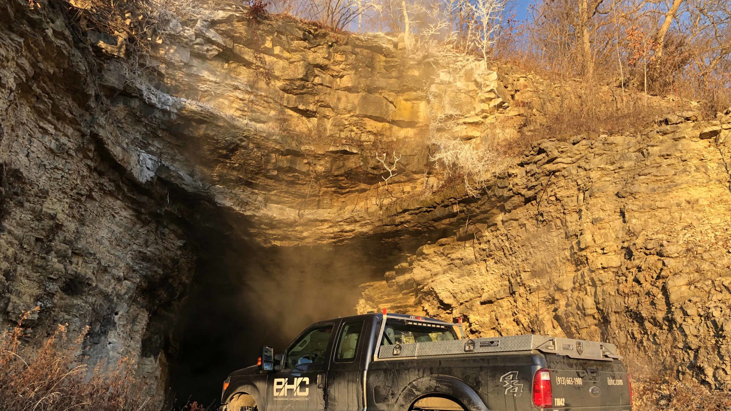
Mine conditions vary depending on the maintenance that has occurred prior to inspection. Oftentimes, mines become filled with water if left to exist without operating a continuous pump. Unattended mines pose numerous risks, like a sinkhole that occurred after a fire engulfed the mine later causing a domeout that perpetuated itself to the surface.
The data collected helps view the mines through an aerial perspective, visually demonstrating where the columns are situated compared to the surface. Boundary surveys are often performed to give the client an idea of where a mine is in relation to a property. If there is knowledge of a mine near a development, it is best to assess its boundary to better understand the quality of land on which a development sits.
In order to assess the conditions of these mines, our surveyors use equipment that quickly gathers accurate data to map the interior of the mine. The GeoSLAM ZEB Horizon Backpack Scanner is a 3D lidar mapping tool that collects thousands of points per second which are then stitched together using a Trimble SX10 developed pointcloud as a base scan.
Due to the efficiency of this device, our surveyors are able to complete scans within a few days depending on the scale of the project. A recent surveying project concerning a 40 acre mine with around 500 columns was completed within three days due to the usage of the portable lidar scanner. A project of this size without the portable survey technology would normally take a month to complete.
Geotechnical Engineering
Geotechnical engineering plays a substantial role in assessing these mines for future developments. Survey data is critically important to geotechnical engineering as it relates to underground mines. Geotechnical engineers use the data collected to determine what the mines geometry is of the material supporting the surface. The principal component of underground assessment is the stability of the allocated area and understanding the total mined area as it related to the surface.
The most efficient way to ascertain the stability of the mine space is looking at the geometry of the mine. One component is the column spacing as it relates to each other and the room openings. Looking at the geometry of the mine in this way helps to determine if the conditions are favorable for long term stability. Determining the stability of the mine will best prepare the development for operational success.
Depending on the end goal of the mine’s transformation, several qualities regarding the natural material must be assessed. When examining the quality of limestone, geotechnical engineers look closely at the following:
- Thickness of the unit
- Thickness of the roof beam
- Jointing patterns
- Fractures
- Parting seams
- Existing anomalies
- Strength and stress of/in the rock
Once a mine has been filled and transformed for the specific instance of collapsing the mine for redevelopment, geotechnical engineers can assess the quality of condensed soil. There are different options when it comes to mine transformation via backfill. Aside from collapse and fill, other options can include flowable fill and screening. Flowable fill requires a mixture of fine aggregate or filler, cementitious material and water which is then filed into the mine. Its fluidity allows it to flow long distances to even the hardest to reach places. Screening deals with the separation of minerals and materials from the excessive elements that are not needed in the backfill process. This can help optimize the backfill of the mine and separate the material for secondary use.
If you are considering a development project regarding a previous mining site, it is best to have the area surveyed to understand the quality of property in question. BHC looks forward to helping you in this process by providing prompt, quality and transparent data. Contact us with any inquiries to learn more about our mine survey services.
Photo Credit: Zach Litvak, BHC Field Survey Technician