Mapping project featured in KSLS August newsletter
A recent post to our LinkedIn account caught the attention an editor at the Kansas Society of Land Surveyors.
Wil Anderson was their first call. Anderson, BHC Vice President and Survey Services Group Leader, is also the Chairman of the KSLS Charitable Foundation. His interview was featured in the KSLS August newsletter and we’re sharing it here with you.
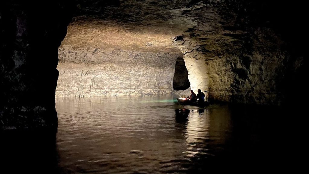
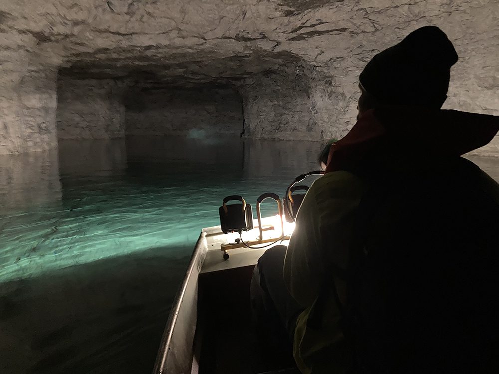
To complete a recent mapping project, BHC surveyors explored deep into Loring mine near the City of Bonner Springs.
The Editor saw this picture in LinkedIn and asked Wil Anderson to give some information on the project — I hope you find it as interesting as I did.
Mines tend to be flooded when they are not in use. The pumps are no longer working and over time get more and more difficult to get into without boats.
BHC has a couple of shallow draft boats which allows us to get into these flooded areas. The scan crew works out from the base line and returns to that same base line similar to a closed traverse.
The advent of the backpack scanners works well as the tool to use to scan and develop the map to allow the evaluation process to move forward. Safety concerns increase the number of staff that are involved.
You also need geologists involved in the evaluation process as most of the mines we have been into have some level of dome out, ceiling collapse in the rooms.
Our deliverable is the mine map showing the columns and rooms, together with surfaces – above ground, ceiling and floor where dry. We do make an estimate on water depth but to give you an idea, in this particular mine the water depth got to around 9 or 10 feet.
The temperature in the mine is extremely stable and cool. It is seen as a prime task for a survey crew in the recent hot weather in and around Kansas City over the last few weeks.
Explore more projects like this on our Surveying Services page.