Telecom
GIS Mapping
Tradewind Energy MSA
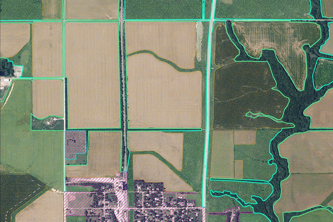
BHC supported Tradewind Energy real estate department by creating land use mapping for the Tradewind Energy MSA project. While working within BHC’s ESRI Enterprise system, multiple GIS analysts using aerial imagery classified over 200 square miles of land use from five possible options. Our quick turnaround of the land use data helped the real estate department meet their external deadlines.