

From Pixels to Points: Implementing LiDAR in Surveying Applications
In the early days, the field of land surveying was a time-consuming endeavor, requiring professionals to painstakingly traverse every inch of a property armed with basic tools and a patient determination. The mapping process was solely ground-based and progressed slowly, often hindered by the challenges of navigating diverse and difficult terrains. However, the march of technology has transformed this landscape entirely.
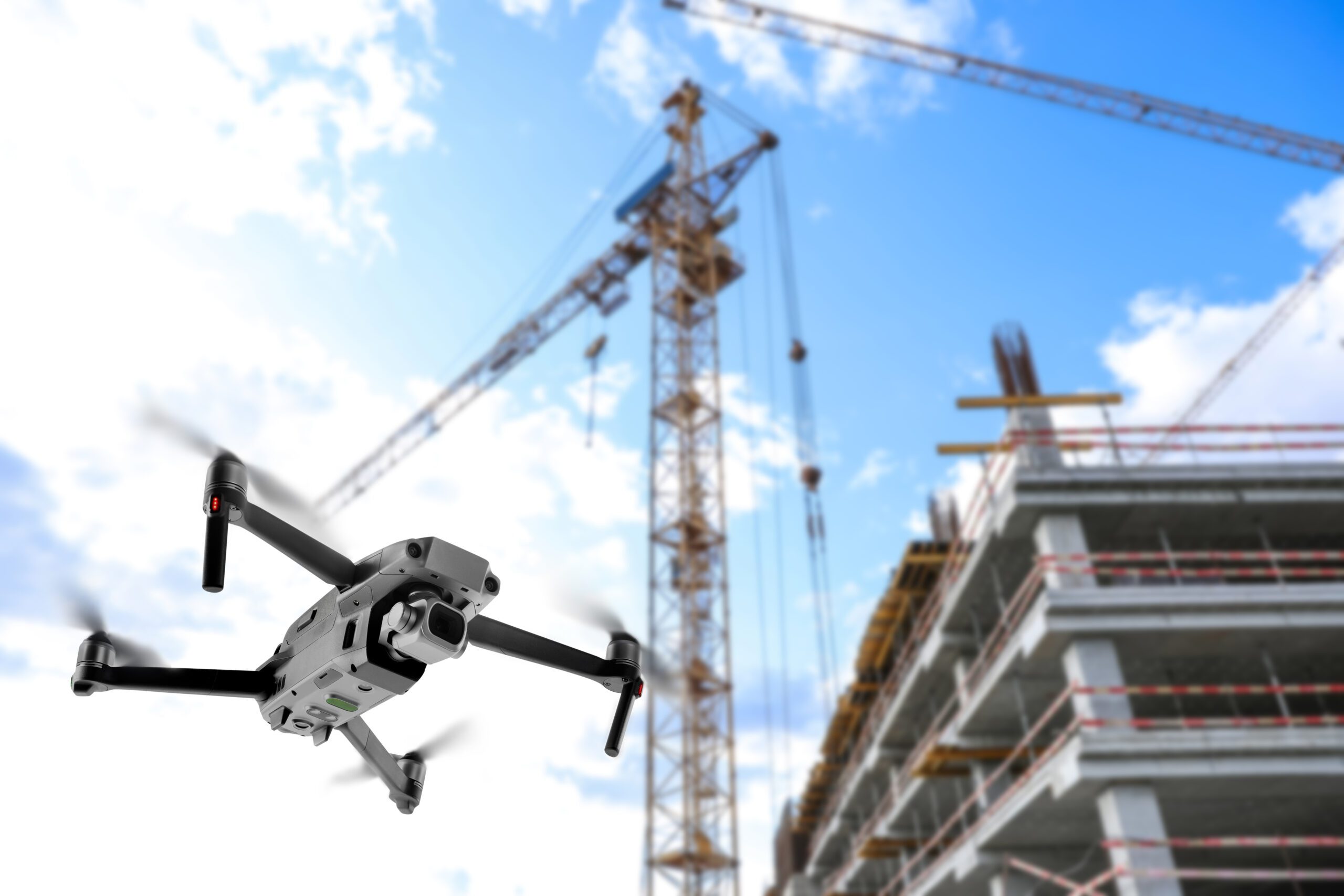
Today, the engineering industry benefits from the remarkable evolution of Unmanned Aerial Vehicles (UAVs) and their revolutionary surveying capabilities. The paradigm shift is truly inspiring: what once required many hours can now be orchestrated with a detailed flight plan, a simple takeoff command, and the swift prowess of a UAV armed with photographic sensors. In a flash, these airborne marvels can meticulously map and survey an expansive area, capturing complex details and elevations with unmatched precision. Aerial photogrammetry in itself has been practiced for quite some time, however, the capability to do so with a UAV has become integral within the industry. The ability to capture an aerial site overview in a short amount of time enhances the quality of deliverables and grants a higher degree of confidence in each project.
BHC’s surveying department takes proactive steps to utilize these technologies, and recently added another cutting-edge tool to their fleet. Initially, two camera-mounted UAVs managed the workload, providing our experts with a bird’s eye view of each site. But now, the department has access to a large, LiDAR UAV (Light Detection and Ranging), enabling comprehensive insights that are particularly valuable in scenarios where depth, elevation, and intricate spatial relationships matter. Generally, aerial photogrammetry is most efficient for recording 1-foot contours. This information is then paired with fill-in survey data to complete the site plan. LiDAR, on the other hand, grants our surveyors even more accuracy and site detail with its elaborate and innovative sensors.
So, What Are Points?
LiDAR is essentially a remote sensing method that uses rapid light pulses to map out the project site. It uses the pulse from a laser to collect measurements, creating 3D models and maps of objects and environments. In a nutshell, the system calculates how long it takes for beams of light to hit an object or surface and reflect to the laser scanner. The distance is then calculated using the velocity of light. Depending on the sensor used, LiDAR scanning units can fire hundreds of thousands of pulses per second. Each of these pulsed laser measurements, or returns, can be processed into a 3D visualization known as a “point cloud.”
With this sensor equipped to our UAV we can paint (or in this case, scan) a vivid picture of the site to streamline the planning, design, and management of projects of all scope. These visualizations can make it easier to design by displaying encroachments, identifying potential risks, and facilitating informed decision making for upgrades, repairs, and additions. Another large advantage to LiDAR scanning is its penetration through foliage and other dense project areas. Another one of BHC’s 3D scanners is the GeoSLAM ZEB Horizon backpack. This equipment has been an incredible resource several times over. The portable scanner collects 300,000 data points per second with a range of 100 meters. The point cloud forms as the surveyor makes their way around a site, proving much more efficient and convenient than traditional surveying equipment. One example of this technology in use is BHC’s work in St. Joseph Church in Topeka, Kansas. This historic building, over 100 years old, required extensive restoration and updating. Our team’s scanners allowed us to gather millions of individual data points, displaying fine details with precision. This high-quality deliverable was used to better understand the project’s complexity, scope, and immediate needs.
The Benefit of “Making Good Points”
As the A/E/C industry is in a state of constant change, adaptation and implementation of cutting-edge technologies becomes not only a necessity but a competitive advantage. One example is the introduction of digital construction staking, something that changes the landscape of engineering yet will soon become commonplace. Changes like these impact project timelines and design efficiency, allowing companies to craft new strategies and business plans. These innovations are not without cost, however. While data collection is much faster than in the past, this equipment is more complex, and also expensive, as specialized equipment requires specialized training.
LiDAR offers unparalleled advantages for surveying and mapping applications. The real benefit of LiDAR is the increased level of confidence, number of accurate data points in each cloud, and its ability to penetrate dense vegetation. As UAVs continue to evolve, so too does the software used to create our deliverables, allowing for more in-depth and easily understood project data. By harnessing the capabilities of LiDAR-equipped UAVs, our company has taken a substantial step towards elevating the quality of our services. This investment will undoubtedly pay for itself in the long-run, and it already has, as we have been able to increase project capacity and provide new innovative, exceptional services.
With such an expansive toolbox, our surveyors have access to a wealth of equipment. Through their knowledge and expertise, we ensure we use the correct tools for each job. While the UAV is a great asset, it is purpose driven; we need a deliverable in mind to make the best use of our assets.
For example, when BHC completed work for the Missouri State Capitol Building, we knew we would be providing a point cloud and survey data to facilitate rehabilitation. We then created exterior surface maps and recorded topography around the site. In the wise words of our Survey Director, Wil Anderson, “You don’t need a sledgehammer to crack a nut. Just because you have a few hammers doesn’t mean you always use the biggest one.” In other words, make sure you completely understand the job and its desired outcome, and then evaluate the most efficient use of the surveying equipment. Surveying is the first step in any design project, so crafting the perfect deliverable is integral to the success of the overall project. This thorough understanding of each project is one of many reasons why BHC is the preferred surveying services provider in the Kansas City region.
Pixels vs. Points
Aerial photography UAVs have proven to be exceptional tools for capturing high-resolution imagery of expansive landscapes and construction sites. Their ability to provide visual documentation from an elevated perspective offers an invaluable overview of project areas. Through aerial photography, engineers and surveyors can easily monitor site progress, identify potential challenges, and communicate project updates to stakeholders. The accessibility of 2D imagery facilitates effective communication and enhances project management, though these images can be subjective.
LiDAR-equipped UAVs, on the other hand, introduce an entirely new dimension to surveying and data collection. This multidimensional approach exceeds the limitations of 2D imagery, providing laser-accurate information at a faster rate. With this equipment, we can look deeper into each project and gain a better understanding of potential issues, alternatives, and efficient design options. LiDAR deliverables include highly accurate point clouds, digital elevation models, and 3D reconstructions. These data types are more objective and can be directly used for measurements and analysis. In summary, aerial photography UAVs excel at providing visual information through high-resolution imagery, while LiDAR UAVs excel at capturing accurate elevation data and 3D models of terrain and objects. The choice between the two depends on the specific requirements of the application and the level of data accuracy needed.
LiDAR Deep Dive
In scenarios that demand precise terrain modeling, volumetric analysis, and the detection of subtle topographical changes, LiDAR’s 3D point cloud data emerges as the superior choice. Construction sites, for instance, often feature complex contours and evolving landscapes. LiDAR captures these nuances with unparalleled accuracy.
Additionally, environmental monitoring projects, such as floodplain mapping and erosion studies, require a holistic understanding of the landscape’s elevation variations. LiDAR’s ability to penetrate vegetation and accurately map ground surfaces empowers engineers to anticipate changes and devise effective mitigation strategies.
Urban planning and infrastructure development also benefit from LiDAR’s comprehensive data packages. Visualizing 3D structures alongside the surrounding terrain aids in site selection, assessing potential obstructions, and optimizing building placement for minimal environmental impact. LiDAR-equipped drones can be deployed to gather information on existing roadways, buildings, and infrastructure. The resulting 3D point cloud data facilitates a deep understanding of the urban landscape, enabling precise alignment.
Our LiDAR UAV comes into play across all segments at BHC. The detailed visuals produced by 3D laser scanning facilitate engineers’ comprehension of project feasibility from the design phase to project completion. Through this analysis, our survey department promotes proactive understanding of requirements before site visits, reducing operational costs and improving outcomes for all stakeholders.
The unparalleled insights garnered from LiDAR-generated point clouds are a testament to the technology’s prowess, yet the realization of these insights requires a specialized skill set. The processing and analysis of LiDAR data demand a high level of expertise and a multidisciplinary approach. Our team of skilled professionals, comprised of surveyors and data analysts, collaboratively transform LiDAR data into actionable intelligence. During the data processing phase, raw LiDAR point clouds are converted into accurate 3D representations of the surveyed area. BHC’s surveyors use Pix4D, filtering out noise, classifying ground and non-ground points, and stitching together individual scans are just a few of the intricate tasks that require expertise. Subsequent analysis involves extracting terrain models, volumetric calculations, and generating visualizations that aid in decision-making.
Wrap-up
In the ever-evolving landscape of infrastructure planning and development, LiDAR technology has emerged as an indispensable asset, ushering in a new era of precision and informed decision-making. As showcased through our projects, the integration of LiDAR-generated point cloud data unveils critical insights that shape the design, construction, and sustainability of urban environments. However, it is important to recognize the true potential of LiDAR is unlocked through the expertise of dedicated professionals who possess the skills to process, analyze, and interpret this intricate data.
Through the marriage of cutting-edge technology and specialized knowledge, BHC continues to pave the way for innovative infrastructure solutions that rise above conventional boundaries. These specialized services will grow our reputation and prove we provide value-add services and deliver ‘No Problem’ service. This enhanced efficiency is a clear demonstration of our commitment to remaining at the forefront of technological progress. By embracing LiDAR and its surveying potential, we position ourselves as pioneers in the industry, displaying our dedication to offering innovative solutions that deliver exceptional results.
Interested in incorporating LiDAR surveying into your next project? Connect with one of our knowledgeable experts today at ibhc.com/connect.